Area Map Design - Mississippi River project

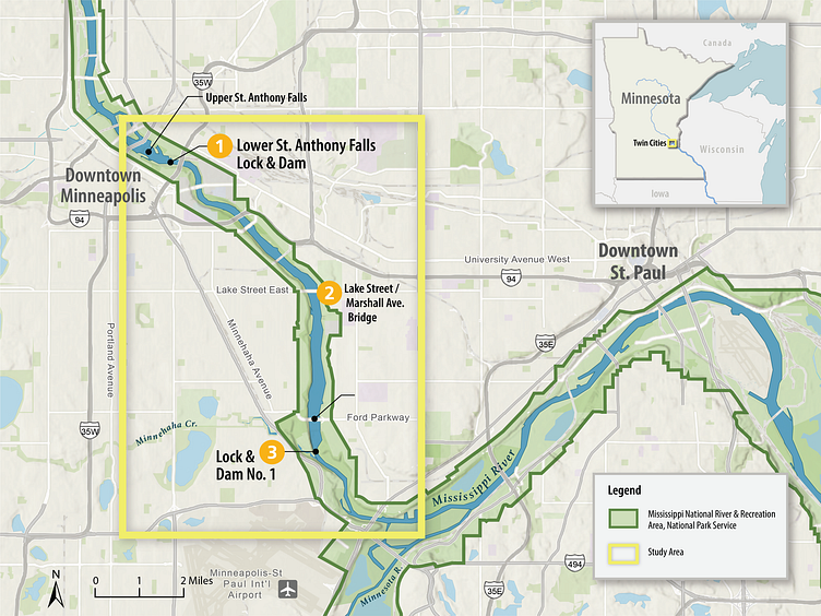
This map was created to support NPCA’s public campaign about a free-flowing Mississippi River between Minnesota’s Twin Cities if the locks and dams were removed. The map was created using basemap information from ArcGIS and cleaned up in Adobe Illustrator with AIX files. Labels and map symbology are added in Adobe Indesign. The final map is an interactive exhibit on NPCA’s website.
To learn more visit www.lvbrownstudio.com
LVBrown Studio provides environmental visual communication illustration, illustrated maps, interpretive signage, and graphic design services.
I’m available for interesting projects!
Email: [email protected]