Illustrated maps

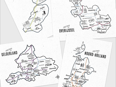
Happy to be sharing another personal project of mine. I’ve been working on this little postcards with vintage inspired maps of the twelve provinces of the Netherlands.
Here you can see the map of Flevoland, Gelderland, Noord-Holland and Overijssel. I tried to include some of the main sights, cuisine, national parks and things that certain places have been know for historically.
This was such a fun project to work on!
Concept sketches were created in Procreate and the vector version in Adobe Illustrator.